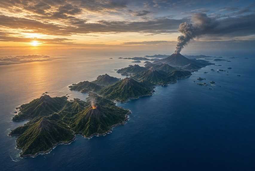
Indonesia is the most volcanically active country on Earth. That fact is not a slogan. It is a geological condition that shapes the nation’s islands, soils, energy potential, tourism, and disaster-response system. In early September 2026, that reality became visible far beyond crater rims: ash from Mount Anak Krakatau drifted across Java and Sumatra, forced temporary closures of major airports including Jakarta’s main international gateway, and disrupted thousands of flights. At the same time, several other volcanoes remained at elevated alert levels.
This article separates confirmed official information as of 8 September 2026 from forecasts and expert interpretation. Volcanic conditions change quickly. Alert levels, exclusion zones, and flight restrictions should always be checked against current Indonesian government notices before travel or fieldwork.
Why Indonesia Has So Many Active Volcanoes
Indonesia sits along the Pacific Ring of Fire, the long belt of earthquakes and volcanoes that encircles the Pacific Ocean. Beneath the Indonesian archipelago, several tectonic plates collide and dive beneath one another. The most important process is subduction: oceanic crust sinks into the mantle, melts in part, and produces magma that rises toward the surface.
That plate collision zone runs from Sumatra through Java, Bali, and Nusa Tenggara, then north through Maluku and Sulawesi toward the Philippines. The result is a volcanic arc of hundreds of cones, calderas, and island volcanoes.
Volcanoes are not only hazards. They help explain why Indonesia is so fertile, why geothermal energy is abundant, why some landscapes draw millions of visitors, and why so many communities live on the slopes of mountains that can erupt.
They remain a major natural hazard because:
Eruptions can begin or intensify with little public warning.
Ash can travel far from the crater and close airports hundreds of kilometers away.
Rain can turn old ash into deadly lahars (volcanic mudflows) long after an eruption ends.
Coastal and island volcanoes can generate local tsunamis if a flank collapses into the sea.
Millions of people live within reach of volcanic products.
Indonesia’s Volcanic Landscape
Indonesia’s Geological Agency records 127 active volcanoes. Of those, 69 are intensively monitored around the clock through 74 volcano observation posts operated by the Center for Volcanology and Geological Hazard Mitigation (PVMBG), under the Geological Agency of the Ministry of Energy and Mineral Resources. Official communications also note that Indonesia has on the order of 500 volcanoes in a broader geological sense, including dormant and poorly documented centers.
Indonesian volcanoes are commonly grouped as:
Type A: documented eruption since about 1600.
Type B: no confirmed historical eruption since 1600, but still show fumaroles or other unrest.
Type C: older volcanic centers with weaker or more limited signs of activity.
In everyday language:
An active volcano has erupted in historical time or shows ongoing unrest.
A dormant volcano is quiet now but capable of erupting again.
An extinct volcano is judged unlikely to erupt again, though that judgment can be revised.
Major volcanic regions
Active volcanoes form an arc across:
Sumatra: Sinabung, Marapi, Sorikmarapi, Dempo and others.
Java: Merapi, Semeru, Bromo, Ijen, Raung and others.
Bali and Nusa Tenggara: Agung, Batur, Rinjani, Tambora, Lewotobi Laki-laki, Ili Lewotolok.
Maluku and North Maluku: Ibu, Dukono, Gamalama, Banda Api.
Sulawesi and Sangihe: Karangetang, Awu, Ruang.
Important volcanoes travelers and residents hear about
Mount Merapi (Yogyakarta and Central Java) is one of Indonesia’s most closely watched volcanoes. It produces lava domes that can collapse into pyroclastic density currents (fast, hot mixtures of gas, ash, and rock often called Awan Panas). As of 8 September 2026, it was at Level III (Siaga). Official hazard advice included lava-avalanche and pyroclastic-flow potential along the Boyong drainage to about 5 km, and along Bedog, Krasak, and Bebeng to about 7 km, with additional sectors on the southeast flank. Hiking to the summit has remained closed under that status.
Mount Semeru (East Java), the highest peak on Java, is a frequent eruptor. MAGMA Indonesia data cited in early September 2026 recorded Semeru as the volcano with the highest number of eruption events in 2026. It was at Level III. Recommendations commonly prohibit activity in the southeast sector along Besuk Kobokan out to 13 km from the summit, with additional caution along river margins because pyroclastic flows and lahars can extend farther.
Mount Lewotobi Laki-laki (East Flores, East Nusa Tenggara) has been one of Indonesia’s most important volcanic crises of 2024–2026. It produced repeated explosive eruptions, high ash columns in 2025, flight disruptions affecting Bali and eastern Indonesia at times, and long-lasting lahar risk in river valleys below the cone. As of 8 September 2026, it was at Level III, with a 5 km exclusion zone from the eruption center in official daily guidance.
Mount Ruang (Sangihe Islands, North Sulawesi) produced major eruptions in April 2024, including very high ash columns, evacuations from Ruang and nearby Tagulandang, and airport closures as far as Manado and beyond. Activity later declined. By December 2025 PVMBG had lowered Ruang to Level I (Normal), with a small crater-approach restriction remaining in later reports. Its last confirmed major eruptive episode was April–May 2024, not 2026.
Mount Anak Krakatau (Sunda Strait) is the young cone growing in the remnant of the 1883 Krakatau caldera. It has a history of Strombolian eruptions, flank collapse, and tsunami risk. It has been at Level III since 2 July 2026. A continuous eruption episode began at 23:07 WIB on 4 September 2026 and ended at 00:04 WIB on 6 September 2026, lasting about 25 hours. Intermittent eruptions continued afterward. The official exclusion radius was 3 km from the active crater. Ash spread toward Banten, parts of West Java, DKI Jakarta, Lampung, and Bengkulu. No fatalities were reported from that episode in official and major news accounts available at the time of writing.
Mount Agung (Bali) is historically dangerous and a major tourism concern whenever it reawakens. As of early September 2026, it was listed among volcanoes at Level I (Normal) on MAGMA Indonesia’s activity-level page. “Normal” does not mean the volcano is harmless; it means monitoring did not show a significant increase above its baseline.
Mount Bromo (East Java) is a famous tourist volcano inside the Tengger caldera. MAGMA listed it at Level II (Waspada) in early September 2026. Separately, park authorities have closed access at times because of wildfires, which are a different hazard from eruption but can still shut tourism. Always distinguish volcanic alert status from park-fire closures.
Mount Ijen is known for its acid crater lake and blue flames. It can be closed for volcanic gas risk, weather, or fire. In early September 2026, access toward Kawah Ijen was reported closed after a land fire near the crater area. That was a park-safety action, not proof of a new major eruption.
Mount Rinjani (Lombok) is a major trekking destination around a large caldera and lake. It can close after earthquakes, fires, storms, or volcanic unrest. It should never be treated as a casual day hike.
Mount Sinabung (North Sumatra) erupted again in late August 2026. PVMBG raised its status from Level II to Level III on 31 August 2026 after an eruption that sent an ash column about 3,500 meters above the peak. It remained at Level III in MAGMA listings on 8 September 2026.
Recent Volcanic Activity and the Current Situation
As of 8 September 2026, MAGMA Indonesia’s public activity-level summary showed:
| Alert level | Meaning in brief | Number of monitored volcanoes |
|---|---|---|
| Level IV (Awas) | Highest warning; eruption threatening settlements | 0 |
| Level III (Siaga) | Clear increase or eruption threatening areas near the vent | 5 |
| Level II (Waspada) | Increasing activity; crater areas restricted | 22 |
| Level I (Normal) | No significant increase above baseline | 42 |
The five volcanoes at Level III were Anak Krakatau, Lewotobi Laki-laki, Merapi, Semeru, and Sinabung.
PVMBG and the Geological Agency have stressed that eruptions on the same day at different volcanoes do not automatically mean one volcano triggered another. Each system is assessed on its own internal monitoring data.
Timeline of major recent events
31 August 2026 — Mount Sinabung, North Sumatra
An eruption produced a dense ash column reported at about 3.5 km above the summit. The alert was raised from Level II to Level III.
Late August 2026 — Multiple eruptions
PVMBG reported eruptions at Ibu, Lewotobi Laki-laki, Ili Lewotolok, Semeru, Anak Krakatau, and Sinabung around the end of August. Officials said these were separate volcanic systems, not one nationwide chain reaction.
4–6 September 2026 — Mount Anak Krakatau continuous eruption
A continuous eruption lasted about 25 hours, from 23:07 WIB on 4 September to 00:04 WIB on 6 September. After that episode ended, activity returned to intermittent Strombolian bursts. The Geological Agency kept the volcano at Level III and said the probability of further eruptions remained high. Ash was observed across several provinces. BMKG reported no sea-level anomaly associated with that eruption in contemporaneous statements, which is important because Anak Krakatau has generated tsunamis in the past. Absence of an anomaly in one episode is not a guarantee for the next.
6–8 September 2026 — Aviation disruption
Ash from Anak Krakatau forced temporary closures at major airports, including Soekarno-Hatta and Halim Perdanakusuma in the Jakarta area, plus airports in Lampung, Banten, and Bandung. By the afternoon of 7 September 2026, Indonesia’s Transportation Minister said volcanic ash had affected 2,961 flights (2,339 domestic and 622 international) and stranded about 341,000 passengers. Earlier tallies on 6 September were lower because the disruption was still growing. Figures changed as closures were extended.
7–8 September 2026 — Semeru, Ibu, and Ili Lewotolok
Seismographs continued to record eruptions at Semeru, frequent events at Mount Ibu in North Maluku, and ash-producing bursts at Ili Lewotolok in East Nusa Tenggara. Mount Ibu was reported at Level II, with a 2 km exclusion zone and an extended 3.5 km sector toward the northern crater opening. Ili Lewotolok produced ash columns of several hundred meters; one event on 8 September was reported with an ash column about 800 m above the summit.
2026 eruption-event counts
MAGMA-based summaries circulating on 8 September 2026 put the nationwide total of recorded eruption events in 2026 at about 4,498. Semeru and Ibu accounted for a large share of that count. These figures measure recorded explosive or eruptive events, not the number of volcanoes that erupted. A persistently active volcano can generate hundreds or thousands of small events in a year.
Important caution: No Level IV (Awas) volcano was listed on MAGMA’s public tally on 8 September 2026. That can change within hours.
Understanding the Volcanic Crisis
A volcanic crisis is dangerous because several hazards can arrive together, and because the most lethal ones can move faster than a person can run.
Volcanic earthquakes record magma and gas moving underground. An increase in deep volcanic quakes, shallow quakes, hybrid events, or continuous tremor often precedes or accompanies eruption.
Ground deformation occurs when magma inflates or deflates the edifice. Scientists measure this with GPS/GNSS, tiltmeters, electronic distance measurement, and satellite radar.
Gas emissions such as sulfur dioxide (SO2), carbon dioxide (CO2), and hydrogen sulfide (H2S) can rise before or during eruption. CO2 can collect in low ground. SO2 irritates lungs and eyes. Acid gases damage crops and metal.
Lava domes grow when sticky magma piles up in a crater. Dome collapse is a classic trigger of pyroclastic flows at Merapi.
Explosive eruptions can throw rocks (ballistic projectiles), build ash columns, and collapse into pyroclastic density currents.
Pyroclastic density currents can exceed highway speeds and exceed 400°C. Survival inside the path is unlikely.
Lahars form when rain remobilizes ash and loose debris. They can travel tens of kilometers down river valleys and remain a threat for months after ashfall.
Lava flows are usually slower than pyroclastic flows, but they destroy everything they cover.
Volcanic ash is pulverized rock, not soft fireplace ash. It abrades aircraft engines, shorts electrical equipment, contaminates water, collapses weak roofs, and injures lungs and eyes.
Tsunamis can be generated by caldera collapse, flank failure, or pyroclastic material entering the sea. Anak Krakatau’s December 2018 collapse is the modern warning case.
Secondary hazards include floods, landslides, crop failure, livestock deaths, water contamination, respiratory illness, and economic disruption.
Activity can change rapidly because magma systems are not steady pipes. A blocked conduit can pressurize. Rain can destabilize a hot deposit. A small explosion can remove a plug and open a larger vent. That is why authorities draw exclusion zones based on the most likely paths of flows and ballistics, not on the pretty viewpoint a visitor wants.
Science and Technology: How Indonesia Monitors Its Volcanoes
Indonesia cannot place a scientist on every crater rim. The monitoring system is a network of instruments, observatory posts, satellites, and public warning platforms.
Seismometers are the foundation. They detect volcanic earthquakes, explosion signals, rockfalls, and tremor. Daily MAGMA reports routinely list counts of eruption quakes, low-frequency events, hybrid events, and continuous tremor.
GPS and GNSS stations measure millimeter-to-centimeter changes in the volcano’s shape. Inflation can mean magma is accumulating. Deflation can mean magma is erupting or withdrawing. Semeru, Merapi, and other priority volcanoes have multi-station GNSS networks.
Tiltmeters and EDM detect local tilting and distance changes on the flanks.
Gas sensors and geochemistry track SO2 and other species from the ground or by campaign measurement.
CCTV and visual observation remain essential. Many daily reports still begin with whether the summit was clear or fogged in.
Thermal cameras and satellite thermal anomalies can detect a hotter crater even when clouds hide the plume from the ground.
Satellite imagery and remote sensing track ash plumes, SO2 clouds, and thermal hotspots. BMKG has used Himawari-9 imagery together with PVMBG eruption notices and the Darwin Volcanic Ash Advisory Center (VAAC) during ash crises.
InSAR (interferometric synthetic aperture radar) measures ground deformation from orbit, including at volcanoes that are too dangerous to approach. It is especially useful between eruptions and at remote cones.
Drones are used for crater photography, mapping new deposits, and inspecting instruments after eruptions.
MAGMA Indonesia is the national multiplatform system that publishes alert levels, daily reports, eruption notices, and Volcano Observatory Notices for Aviation (VONA). Data typically move from field sensors to a local observation post, then to PVMBG in Bandung.
Early-warning practice is multi-parameter. Scientists do not wait for one spectacular explosion. They combine seismicity, deformation, gas, visuals, and satellite data. If several independent signals worsen together, the alert can rise even before a large plume is seen.
Artificial intelligence and machine learning are being explored and used in research and operational support worldwide for classifying seismic signals and scanning satellite imagery. In Indonesia, the operational backbone remains instrument networks plus expert interpretation at PVMBG. Claims that AI “predicts eruptions with certainty” are not supported. Forecasting is probabilistic, not a calendar date.
Satellites matter most when a volcano is too dangerous for close fieldwork. After instruments are destroyed, as happened at some eruptions including Ruang in 2024, satellite thermal, ash, and SO2 observations may be the only continuous view.
Volcanoes and Aviation
Volcanic ash is one of the few natural hazards that can shut a capital-city airport without destroying the runway.
Ash particles melt inside jet engines, then resolidify on turbine blades. They also sandblast windshields and pit exposed surfaces. Pilots cannot safely fly through a dense ash cloud, and ash is hard to see at night.
That is why even a relatively modest eruption can disrupt international flights. Anak Krakatau is more than 150 km from Jakarta, yet ash on 6–7 September 2026 closed Soekarno-Hatta and other airports. Wind, not just eruption size, decides who is affected.
Aviation authorities use:
VONA messages from PVMBG, with color codes such as Green, Yellow, Orange, and Red.
VAAC Darwin ash advisories for the region.
NOTAMs that close airspace or airports.
Satellite and weather-model tracking of plume height and drift.
Ash at high altitude can affect routes that never intended to fly near the volcano. That is why Bali, Jakarta, Lombok, or Labuan Bajo flights can be cancelled after an eruption in Flores or the Sunda Strait.
Impact on Local Communities
Short-term impacts include evacuation, school closures, cancelled fishing, damaged roofs, contaminated wells, dead livestock, and lost harvests. Ash can halt outdoor work and close roads. Heavy deposits collapse houses. Lahars bury bridges and irrigation canals.
Longer-term consequences include displacement, loss of farmland, trauma, and the cost of rebuilding. After large events such as Ruang 2024, some residents moved into longer-term relocation housing rather than return immediately to the island.
Yet communities remain on volcanic slopes because:
Volcanic soils are often highly fertile.
Farming, sand mining, and tourism are local livelihoods.
Villages and cultural sites have been there for generations.
Not every eruption reaches every village.
Moving an entire community is socially and economically difficult.
This is not ignorance. It is a calculated, sometimes reluctant, coexistence with risk.
Impact on Travelers and Tourism
Popular volcanic destinations include Bromo, Ijen, Rinjani, Batur, Agung viewpoints, and parts of Flores and North Sulawesi. People come for sunrise calderas, crater lakes, cultural landscapes, and the feeling of standing on a living planet.
Those same places can close with little notice. An eruption, a raised alert, a wildfire, or an ash cloud over an airport can cancel a trip even if the hotel is still standing.
A useful distinction:
Tourist volcanoes at lower alert may still be visitable on official routes.
Volcanoes at Level III or IV are not sightseeing destinations.
Park closures for fire or weather can shut a mountain that is not erupting.
As of 8 September 2026:
Merapi hiking routes were closed.
Semeru had a large restricted sector and is not a casual trek.
Lewotobi Laki-laki had a 5 km exclusion zone.
Anak Krakatau had a 3 km sea-and-land exclusion; boat tours toward the crater were unsafe.
Agung was at Normal, but conditions can change.
Bromo was at Level II and has also seen fire-related closures in 2026.
Ijen access was affected by fire-related closure reports in early September 2026.
Tourists should treat social-media photos as marketing, not permission.
Travel Safety and Precautions
Before traveling
Check official volcanic alert levels on MAGMA Indonesia and Geological Agency notices.
Read the specific exclusion radius for that volcano. Radii differ.
Check airport status, airline messages, and ash advisories if flying.
Use licensed local operators who follow park and PVMBG rules.
Buy travel insurance and read the natural-disaster wording. Many policies limit ash-related claims.
Pack an N95 or better respirator, sealed eye protection, a head covering, and a small supply of drinking water.
Identify evacuation routes if staying near a volcano or river valley.
Do not plan a summit hike on a Level III or Level IV volcano.
During volcanic activity
Stay outside restricted zones.
Obey evacuation orders immediately.
Avoid river valleys and low ground after heavy rain.
Stay indoors during heavy ashfall. Close windows and doors.
Do not drive if ash is falling hard; ash reduces traction and clogs engines.
Do not approach an eruption for photographs.
If exposed to volcanic ash
Wear a well-fitted respirator. A thin fashion mask is not enough for heavy ash.
Protect eyes with wraparound goggles. Contact lenses are a poor choice in ash.
Wear long sleeves and long trousers.
Remove outdoor clothing before entering living space.
Clean ash with water carefully; dry sweeping puts dust back into the air.
Do not wash large amounts of ash into drains if authorities advise against it.
Seek medical care for breathing difficulty, especially for children, older adults, and people with asthma.
Volcano Photography and Social Media Risks
Dramatic night photos of lava and ash columns are easy to share and hard to survive.
People have entered exclusion zones at Indonesian volcanoes for content. That behavior is dangerous because:
Pyroclastic flows can appear with little obvious buildup.
Ballistic rocks can land far beyond the crater rim.
Gas pockets can be invisible.
Night photography often means standing in the dark on unstable ground.
A “quiet” crater can explode while a camera is being set up.
Exclusion zones exist because scientists mapped the likely killing zone. Crossing them for a photograph is not courage. It is a decision that can also endanger rescuers.
Economic and Environmental Impact
Volcanic crises hit tourism revenue, agriculture, small businesses, transport, and government emergency budgets. Ash closes airports and hotels. Farms lose a season. Fishing boats stay in port. Schools shift online. Local guides lose work.
There is another side. Volcanic soils support intensive agriculture on Java and Bali. Volcanic terrains host unique ecosystems. Indonesia also has substantial geothermal potential because the same heat that feeds eruptions can generate electricity when tapped in stable fields away from active vents.
After an eruption, ecosystems can recover in stages: first pioneer plants on new deposits, then gradual return of forests where climate and seed sources allow. Recovery is uneven. Thick welded deposits and acid lakes recover slowly.
Volcanoes are therefore both a disaster source and a long-term environmental engine. Policy has to hold both facts at once.
Indonesia’s Disaster-Response System
The main national actors are:
PVMBG / Geological Agency: monitoring, alert levels, exclusion recommendations, VONA.
MAGMA Indonesia: public information platform.
BNPB: national disaster management, coordination, logistics, and some emergency operations such as weather modification during ash problems.
BMKG: weather, ash-dispersion analysis, sea-level monitoring.
Local governments and BPBD: evacuation centers, local warnings, community readiness.
Park authorities: trail closures at Bromo, Ijen, Rinjani, Merapi and others.
The four-tier alert system
Under Indonesian regulations, volcanic activity levels are:
- Level I — Normal
No significant increase above the volcano’s usual behavior. Toxic gas can still exist at some craters. - Level II — Waspada (Advisory)
Activity is increasing. People should stay out of a defined crater radius. Emergency planning begins. - Level III — Siaga (Watch / Standby)
Increase is clear, or an eruption threatens the area around the vent. Broader restrictions apply. Communities in higher-risk zones should be ready to evacuate. - Level IV — Awas (Warning)
A major eruption is occurring or judged imminent and threatens settlements. Evacuation of designated hazard zones is required.
These levels are not a tourist rating. A Level II volcano can still kill someone who walks into the crater.
Community preparedness includes observation posts, sirens or messenger networks in some areas, school drills, and local knowledge of river valleys. The system works best when people treat official radii as binding, not optional.
Climate and Global Effects
Most Indonesian eruptions affect local weather and air quality: darker skies, ashfall, irritated lungs, and short-term cooling under a plume.
A few very large explosive eruptions can inject sulfur into the stratosphere, forming sulfate aerosols that reflect sunlight and cool climate for a year or two. The 1815 eruption of Tambora is the historical extreme from Indonesia. The 1883 Krakatau eruption also had wide atmospheric effects.
The ordinary 2026 eruptions described above, including frequent Semeru and Ibu events and the September Anak Krakatau episode, should not be described as global climate-changing events on present evidence. The 2024 Ruang eruptions did inject material high into the atmosphere and were later studied from satellite platforms for stratospheric aerosol, but that is a specific large event, not the default outcome of every Indonesian eruption.
Distinguish clearly:
Local ash and SO2: common.
Regional aviation and air-quality effects: occasional.
Measurable global climate forcing: rare and reserved for the largest sulfur-rich, high-altitude eruptions.
What Travelers to Indonesia Should Know About Volcanoes in 2026
Indonesia remains open to travel. It is not a single volcano. A crisis at Anak Krakatau can close Jakarta airports while Bali beaches are clear, or an eruption in Flores can affect Bali flights while Java is unaffected.
In 2026, extra caution is warranted around:
Anak Krakatau and Sunda Strait boat tours
Merapi
Semeru and the Besuk Kobokan drainage
Lewotobi Laki-laki and nearby Flores valleys
Sinabung
Any volcano listed at Level II or higher
How to respond to sudden change:
Recheck the official alert, not a social post.
Contact your airline and hotel.
If ash is falling, stay inside.
If an evacuation order is issued, leave.
If your itinerary depends on a specific volcano hike, have a non-volcano backup.
Cancel or change plans when:
Your destination is inside an exclusion zone.
Your flight hub is under an ash NOTAM.
Local authorities close the park.
You cannot obtain current official information and the volcano is at Level III or IV.
Essential supplies for volcanic regions: respirator, goggles, flashlight, charged phone, offline maps, water, and a copy of key documents.
Future Risks and Scientific Outlook
Indonesia will continue to have eruptions because the tectonic setting has not changed. Subduction is still active. Magma will keep rising.
Scientists can often detect unrest. They can rarely issue a precise eruption time, size, and direction weeks in advance. The limits are real: magma can stall, a planned explosion can be small, or a collapse can come faster than models expect.
Monitoring is improving through denser seismic and GNSS networks, better satellite cadence, drone mapping, and faster public dashboards. AI may help classify signals and flag anomalies. It will not replace geology.
Climate change may worsen secondary volcanic hazards by changing rainfall intensity, which affects lahar frequency, or by stressing communities already living on unstable slopes. That is a plausible risk interaction. It is not the same as claiming climate change causes magma to form.
Indonesia Volcanoes: Key Facts
| Topic | Key information (verified to 8 September 2026) |
|---|---|
| Active volcanoes | 127 recorded by the Geological Agency |
| Intensively monitored | 69 volcanoes via 74 observation posts |
| Major volcanic setting | Sunda–Banda volcanic arc on the Pacific Ring of Fire |
| Monitoring agency | PVMBG / Geological Agency, with MAGMA Indonesia as the public platform |
| Disaster coordination | BNPB, local BPBD, BMKG for weather and ash dispersion |
| Alert system | Level I Normal, II Waspada, III Siaga, IV Awas |
| Level III volcanoes on 8 Sept 2026 | Anak Krakatau, Lewotobi Laki-laki, Merapi, Semeru, Sinabung |
| Level IV volcanoes on 8 Sept 2026 | None listed |
| Main hazards | Pyroclastic flows, ash, lahars, ballistics, gases, lava, local tsunami at some island volcanoes |
| Major recent focus | Anak Krakatau 25-hour eruption, 4–6 September 2026; nationwide multi-volcano activity |
| Aviation impact of that episode | About 2,961 flights and 341,000 passengers affected by 7 September afternoon, according to the Transportation Minister |
| Main travel risks | Entering exclusion zones, ash-disrupted flights, river-valley lahars, unguided crater hikes |
Frequently Asked Questions
- Why does Indonesia have so many volcanoes?
Because it sits on a subduction zone in the Pacific Ring of Fire, where oceanic plates sink and generate magma. - How many active volcanoes are in Indonesia?
The Geological Agency records 127 active volcanoes. Sixty-nine of them are intensively monitored. - Which Indonesian volcanoes are currently active?
Many are active in the geological sense. As of 8 September 2026, five monitored volcanoes were at Level III: Anak Krakatau, Lewotobi Laki-laki, Merapi, Semeru, and Sinabung. Others, including Ibu and Ili Lewotolok, were producing eruptions at lower official levels. - What is the most dangerous volcano in Indonesia?
There is no single answer. Merapi threatens dense populations. Semeru produces frequent flows and lahars. Anak Krakatau can affect sea and air routes and has tsunami potential. Lewotobi Laki-laki has produced high columns and long-distance ash. Danger depends on eruption style and who lives or travels nearby. - Is it safe to visit Mount Bromo?
Sometimes, on official routes, when the park is open and the alert level and fire conditions allow it. Bromo was at Level II in early September 2026 and has also been closed for wildfires. Check Park authorities the same week you go. - Is Mount Rinjani safe to climb?
Only when the national park is open and weather, seismic, and volcanic conditions allow it. It is a serious multi-day trek, not a guaranteed itinerary. - Can volcanic eruptions affect flights to Indonesia?
Yes. The September 2026 Anak Krakatau ash cloud closed Jakarta-area airports and disrupted thousands of flights. - What should tourists do during a volcanic eruption?
Leave restricted zones, follow official orders, stay indoors during ashfall, protect lungs and eyes, and do not travel toward the volcano. - How does Indonesia monitor its volcanoes?
With seismometers, GNSS/GPS, tilt and gas measurements, CCTV, satellites, drones, observatory posts, and the MAGMA Indonesia warning platform. - Can scientists predict volcanic eruptions?
They can often detect unrest and raise alert levels. They cannot reliably predict exact time and size far in advance. - What is the Ring of Fire?
It is the belt of earthquakes and volcanoes around the Pacific Ocean, produced by plate subduction and collision. - Which Indonesian volcanoes are most closely monitored?
Priority systems include Merapi, Semeru, Anak Krakatau, Lewotobi Laki-laki, Sinabung, and other Type A volcanoes with observation posts. Merapi in particular has one of the densest instrument networks.
Volcanoes in Indonesia are a permanent feature of the country’s geology, not a passing news cycle. The September 2026 ash disruption over Java showed how quickly a local eruption becomes a national transport problem. The scientific response — instrument networks, satellite tracking, alert levels, and public bulletins — is what makes coexistence possible. For residents and travelers, the practical rule is simple: treat official exclusion zones and aviation notices as facts, not suggestions, and assume that a quiet-looking crater can change on the next watch.
 |  |  |